All proceedings reinvested in research!!
Now on sale: FatFonts World Population Maps
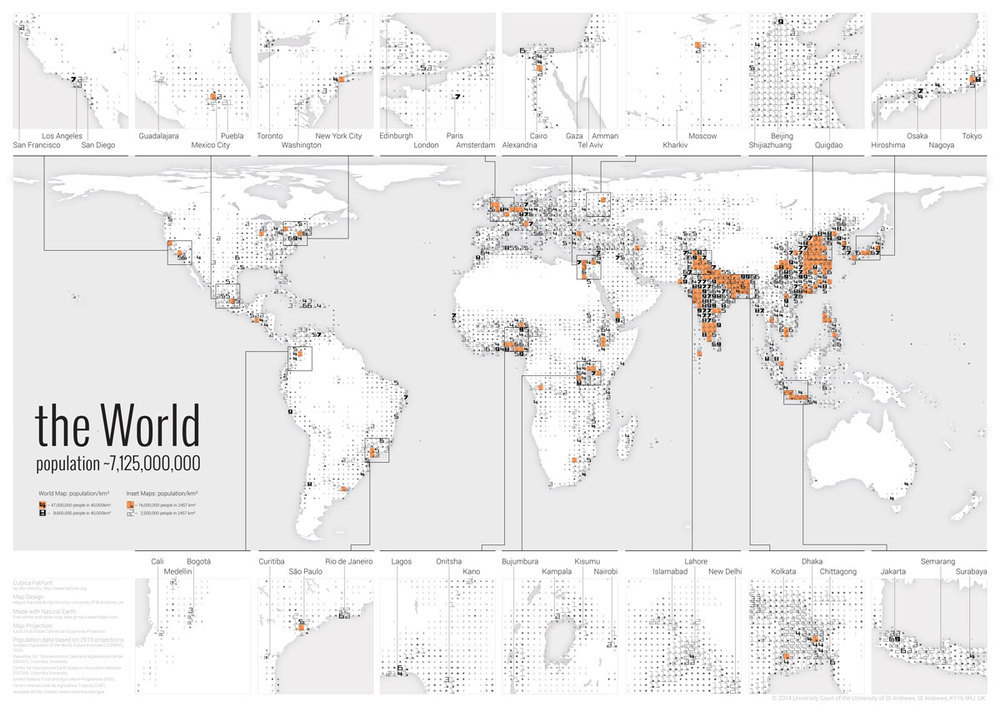
Looking for a gift for a visualization aficionado? We are happy to announce that the first ever FatFonts World Population Map is now available in the Axis Maps store. All proceeds from the maps will be used to fund more FatFont-related research.
The map shows how the population of the world is distributed. It uses a typographic visualization technique – FatFonts –which allows you to read the exact number of people living in a particular area with a precision within 100,000 people. Each number in the world map corresponds to the population in an area of approx. 40,000 km².
Find more information:
A blog post by Miguel, with some personal comments.

0 Responses to “FatFonts World Population Poster now on sale”